Posts

Showing posts with the label Heritage areas

Ghodbunder fort - A 16th century marvel on Salsette island.

Image
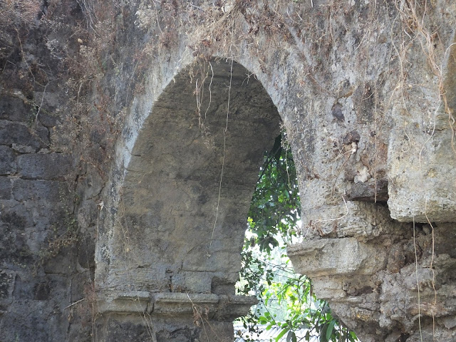
Apart from the rich history that is attached to the formation of India and its legend, Mumbai has a unique chapter and can make historian's minds heavy. Mumbai's culture act as pure palimpsest and is a complete meal for anyone suffering from a deficiency in history lessons. The numerous forts scattered around the city are a testimony for the same. It comes as surprise to many that there were in total 11 forts in the city. Sitting on the urban fringe of Thane city and on a hill just south of Ulhas river and overlooking the natural creek on its west side, Ghodbunder fort is one of the forts and Mumbai's 16th-century marvelous piece of architecture. The humble Ghodbunder road, the state highway that connects Thane with the northern suburbs of Mumbai today once acted as a bridge between different cultures. The significance of this place was such that it is said to have played a crucial role in Indo- Arab trade which the Portuguese later used to monopolize sea routes in the Arab

A village in heart of Mumbai which boast of more than 1500 years of existence - Marol village heritage walk.

Image
Standing on the fringes of Aarey forest, lies Marol village, a mid point between the western and central suburbs of Mumbai. Today it may have lost its sheen but it has been in existence from more than 1500 years and was once an important trading center along with Kondivita (Mahakali caves area) and Prajapur area inside Aarey. This surely would raise many eyebrows !!  Archaeologist have confirmed that Marol indeed was an important trading center along with Kondivita (Mahakali caves area) and Prajapur (now a slum in Aarey). Trade would happen with various ports of that era namely Mahim, Sopara etc and one theory goes that there would gave existed land routes from pre historic ports to these towns located on mainland. Another theory is that trading may have also happened via Mithi river which is today not more than a sewage, but was once an important river which flowed close to Marol and discharged into Mahim creek. These rivers were trading channels with boats moving from the ports inwar

Discovering the lesser known heritage secrets of Byculla neighbourhood

Image
Byculla in the 19th century was part of textile mills belt of Bombay, It is said that there were in total 136 mills operating in areas of Parel, Lalbaug, Byculla, Prabhadevi, Chinchpokli etc which collectively was known as "Girangaon" meaning "Village of mills". By 1982 the textile mills had started to struggle and with the famous "Greater Bombay textile strike" which lasted for 18 months,by which time most of these mills had closed down. Byculla with its neighbourhood of Nagpada, Agripada, Chinchpokli, Kamathipura and the Mazgaon docks became known for its underworld activities. Today there are no strikes, underworld activities at its near zero and what we see now are the high rise building towers. But within all this there is another side of Byculla - the 18th century Byculla . Byculla came into existence as an extension of Mazgaon - one of the seven islands of Bombay. The low lying flat land which used to be flooded during high tide was made inha